基金项目:国家自然科学基金项目( 51409204、41401496);陕西省自然科学项目( 2015JQ4105);陕西省教育厅项目( 16JK1496);江西省数字国土重点实验开放基金项目(DLLJ2015604)
作者简介:汪康宁,硕士研究生通讯作者:吕杰,博士;E-mail:rsxust@163.com
作者简介:汪康宁,硕士研究生通讯作者:吕杰,博士;E-mail:rsxust@163.com
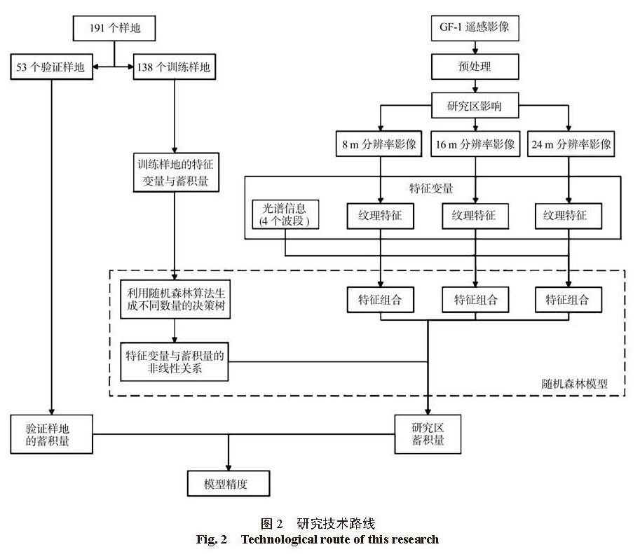
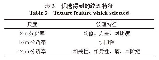
 ),按节点不纯度最小原则选择出一个最优特征,作为节点构建决策树,最终得到若干棵决策树。最后,用这些决策树对数据集进行回归,最终使用采用简单多数原则确定数据集的反演结果。