基金项目:国家发展改革委北斗卫星导航产业重大应用示范发展专项“北斗卫星导航在林业中的示范应用工程项目”(发改办高技〔2014〕2563号)
作者简介:胡鸿,工程师通讯作者:吴东亮,博士; E-mail:314543494@qq.com
作者简介:胡鸿,工程师通讯作者:吴东亮,博士; E-mail:314543494@qq.com
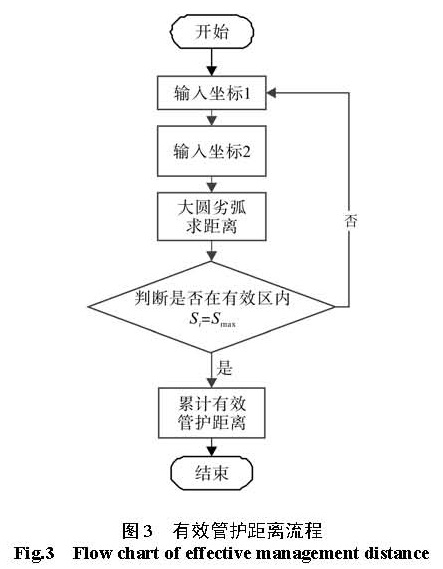
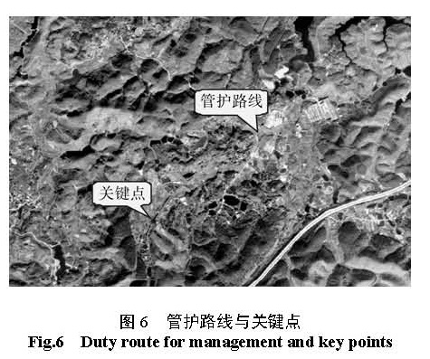
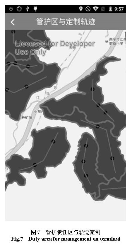
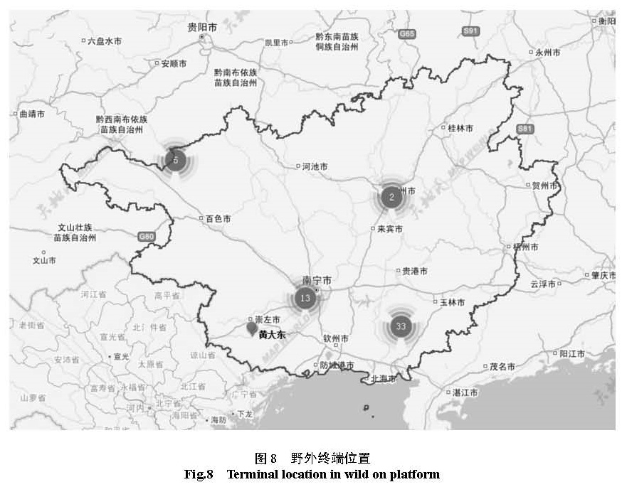
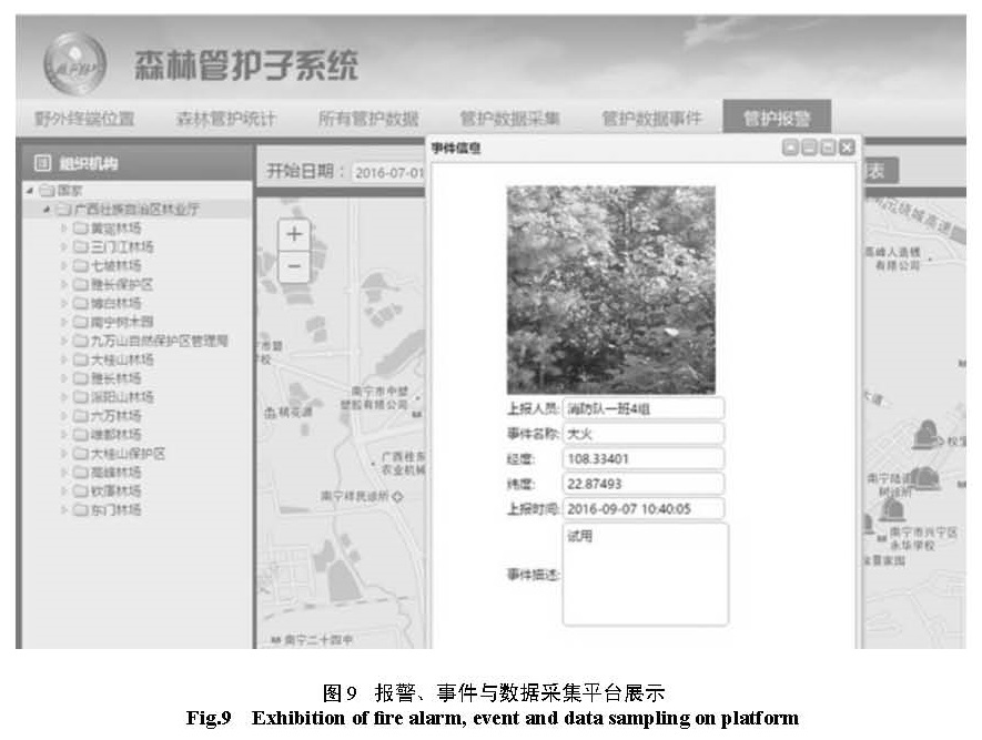
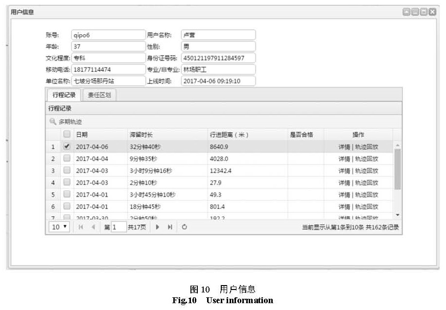
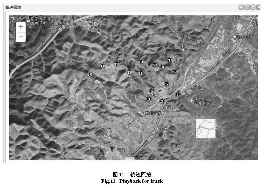
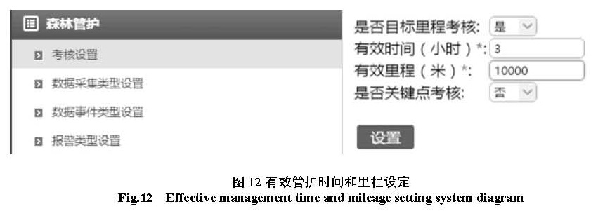
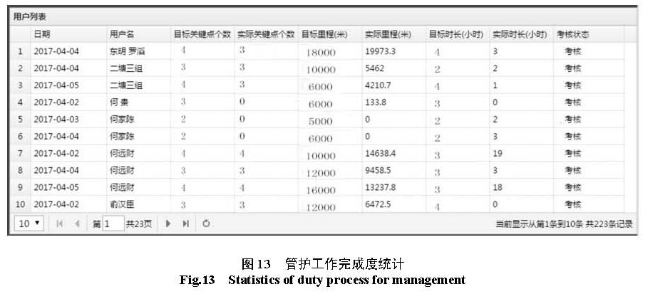
长期以来,我国卫星导航应用过渡依赖 GPS,风险巨大。近年来,国家大力支持并积极推动我国自主研发的北斗卫星导航系统的应用。与此同时,我国林业对卫星定位导航的需求也日益增加,采用自主知识产权的北斗卫星导航系统符合目前我国林业的要求。以基于位置服务的理念,采用北斗卫星导航技术,结合森林管护业务流程,研发出新型的森林管护管理系统。该系统将定位导航等位置服务融入到日常管护人员的工作中,完成诸如电子围栏、有效管护、定点打卡、巡护路线、巡护轨迹、以及管护考核等一系列新的管理模式,有效地防止森林管护不规范、不到位等问题的发生,实现对森林管护工作的精细化管理,加强对森林管护的检查与监督力度,提高了森林管护工作的效率和质量。
For a long time, China’s satellite navigation applications rely on GPS transition and the risk is enormous. In recent years, the state has vigorously supported and actively promoted the application of the Beidou satellite navigation system independently developed by the country. At the same time, the demand for satellite positioning and navigation in China’s forestry is increasing day by day and the Beidou satellite navigation system with independent intellectual property rights is in line with the requirements of forestry in china. Withthe concept of location based service ofthe Beidou satellite navigation technology and combined with the forest management business process,the new forest management system was developed.The system involved and location services and navigation into the daily management work, such as electronic fence, effective management, point card, patrol route, patrol track, evaluationetc., which formsa series of new management mode.It effectively prevents the problems thatthe forest management is not standardized and noton-the-right-place of out-door-work, strengthensthe inspection and supervision of forest management, and improves the quality and efficiency of forest management work.